Share this Post
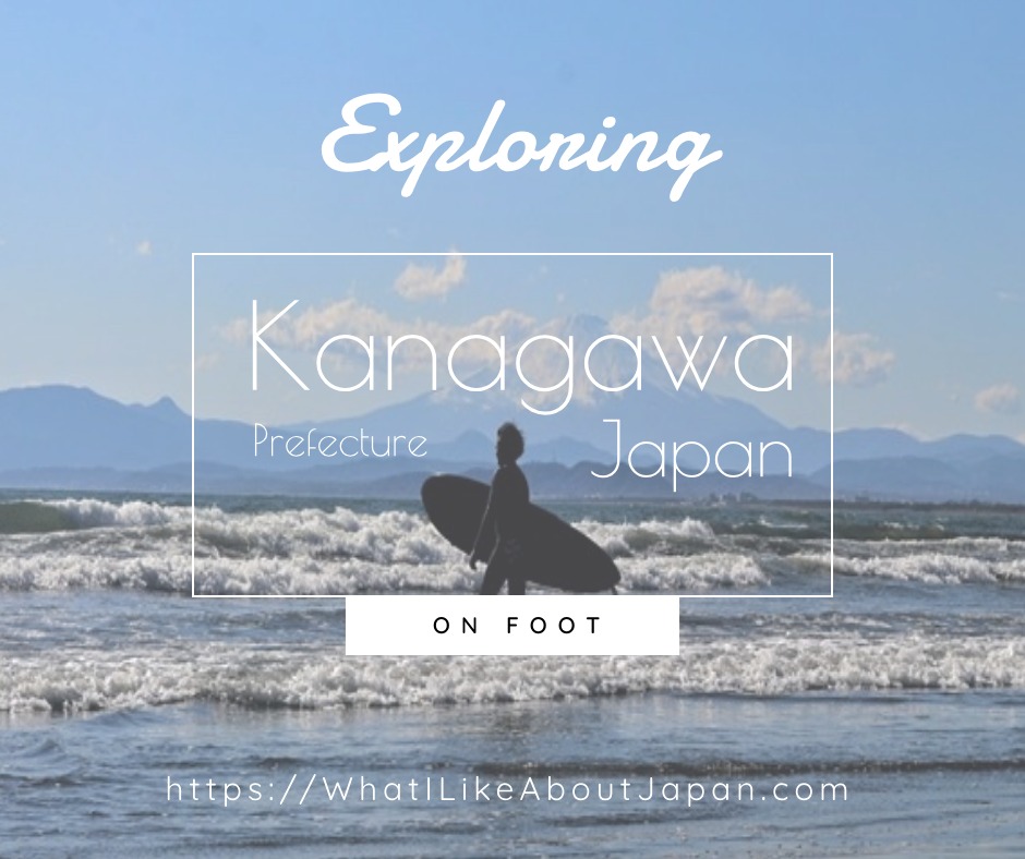
Let’s Go Explore Kanagawa!
Kanagawa Walking Courses run through out the prefecture from every major city to the mountains in the countryside! Here is the basic information to go outdoors and roam the prefecture and get to know its major cities such as Yokohama, Kawasaki, and Yokohama, while still basically doing Social Distancing. Just remember to practice the three Cs: No Crowds, No Closed Spaces, and No Close Conversations. And don’t to forget to bring along a medical mask for good measure. Let’s go walking!THERE ARE TWO CHOICES FOR EXPLORING KANAGAWA
CHOICE ONE – KANTO FUREAI NO MICHI : THE CAPITAL TRAIL SYSTEM
These courses are all over Kanto; including Tokyo, Saitama, Chiba, KANAGAWA, Yamanashi, and Tochigi. It meanders through the back countryside of the different prefectures and takes in the natural and cultural spots. This system of walking courses was created by the prefectures twenty or more years ago, before it was felt necessary to have a web presence. Even the guide materials have run out a long time ago. There are markers all around with huge beginning and ending placards talking about the courses and maps. Here and there are descriptions about the place and its history. It’s a great for exploring Kanagawa prefecture and a bit beyond for the ambitious. This course system goes between and connects the different prefectures of Kanto and maybe some beyond. It is pretty old and well-established. However it is in the countryside so it can be deemed unnecessary travel a bit beyond what is necessary for basic exercise. But if you live near one of these then definitely check it out! However, it is all in Japanese and the current government information, even the most up to date information on the internet, seems a little minimalistic. So if your Japanese is fluent and you don’t mind getting a little lost from time to time, but are confident you can find your way back without much trouble, then this is pretty good. But if your Japanese is not so great, then be ready to fire up your smartphone’s Google Translate and Google Maps, because you are in for the best slow moving walking adventure that Kanto has to offer.OFFICIAL ALL JAPAN LONG DISTANCE NATURE TRAIL SYSTEM COURTESY OF THE MINISTRY OF THE ENVIRONMENT
OFFICIAL KANTO FUREAI NO MICHI TRAIL SYSTEM COURTESY OF THE MINISTRY OF THE ENVIRONMENT
CHOICE TWO – CITY AND WARD SPECIFIC WALKING COURSES
These courses are a great way to get to know the history, nature, and culture of specific wards of Kawasaki, Yokohama, Odawara, Kamakura and many other smaller cities and municipalities in Kanagawa prefecture. And it seems that just about every city has their own fairly well maintained web site giving a lot of information about their courses. So wherever you are in Kanagawa, check out your local city’s Walking Course site and you should find something interesting nearby. Get ready to find something interesting in areas you hadn’t thought to look at before or something new about an area that you have been to many times. These courses are usually part of the cities’ attempts to market themselves for outside Japanese visitors, so English is sometimes available, but usually not. It just depends on the city. Just be ready to fire up your smartphone’s Google Translate and Google Maps before you go. Cities such as Yokohama, Kawasaki, and Kamakura have English versions of their maps for foreign visitors. But smaller less well known cities such as Odawara and smaller probably don’t.A word of warning, the city hiking courses do not always cross into other cities. So get ready to get to know one at a time, really, really well! That being said these are the most comprehensive ways to get to explore Kanagawa prefecture as well as cities such as Yokohama, Kawasaki and Odawara.
Exploring Kanagawa Prefecture City by City
Kanagawa Prefectural Maps for Walking Courses in Many Cities in Kanagawa Prefecture (Almost All In Japanese)
https://www.pref.kanagawa.jp/docs/mv4/mymebyo/walk/walkingmap2.html
AC
E
F
H
I
K
M
O
S
Y
A
H
I
K
M
N
S
T
Z
Other Links and Resources
Image thanks to Ye Linn Wai @ Unsplash
|
|
|
|


![[商品価格に関しましては、リンクが作成された時点と現時点で情報が変更されている場合がございます。] [商品価格に関しましては、リンクが作成された時点と現時点で情報が変更されている場合がございます。]](https://hbb.afl.rakuten.co.jp/hgb/1d59398d.a4da2148.1d59398f.e1fb9114/?me_id=1251035&item_id=11414591&pc=https%3A%2F%2Fthumbnail.image.rakuten.co.jp%2F%400_mall%2Fhmvjapan%2Fcabinet%2F2930000%2F2929999.jpg%3F_ex%3D240x240&s=240x240&t=picttext)

![[商品価格に関しましては、リンクが作成された時点と現時点で情報が変更されている場合がございます。] [商品価格に関しましては、リンクが作成された時点と現時点で情報が変更されている場合がございます。]](https://hbb.afl.rakuten.co.jp/hgb/17fc7800.d26d61a1.17fc7801.606d0dbf/?me_id=1213310&item_id=16743001&pc=https%3A%2F%2Fthumbnail.image.rakuten.co.jp%2F%400_mall%2Fbook%2Fcabinet%2F0927%2F9784046000927.jpg%3F_ex%3D240x240&s=240x240&t=picttext)


